We use cookies to improve your experience on our site and to show you relevant advertising.
To find out more, read our updated privacy policy and cookie policy. Read more


 Unique Christian Gifts from Jerusalem, the Heart of the Holy Land
 Worldwide Shipping
 Money-Back Guarantee
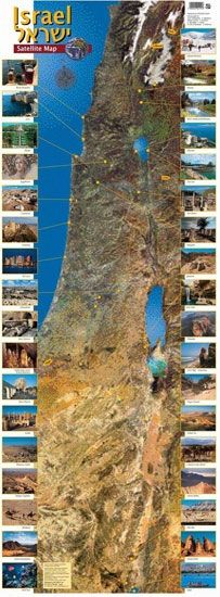
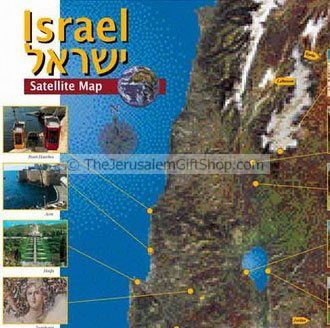
Israel - as seen from the heavens - We are very happy to be able to present this unique satellite map of the Holy Land.
This image was made by merging the satellite data from NASA's Landsat 5 satellite and the French SPOT satellite. The result is a highly accurate, true-color, photo-realistic, satellite map of the Holy Land.
Size: 13 x 37 inches.
Shipped to you direct from the Holy Land.
| EAN | 7290109632216 |
|---|
Write Your Own Review

Related Product